Why a Valley Changes the Route of a Road
Why a valley changes the route of a road becomes clear from slopes, streams, and passes—clues that help you read a winding line on the map.
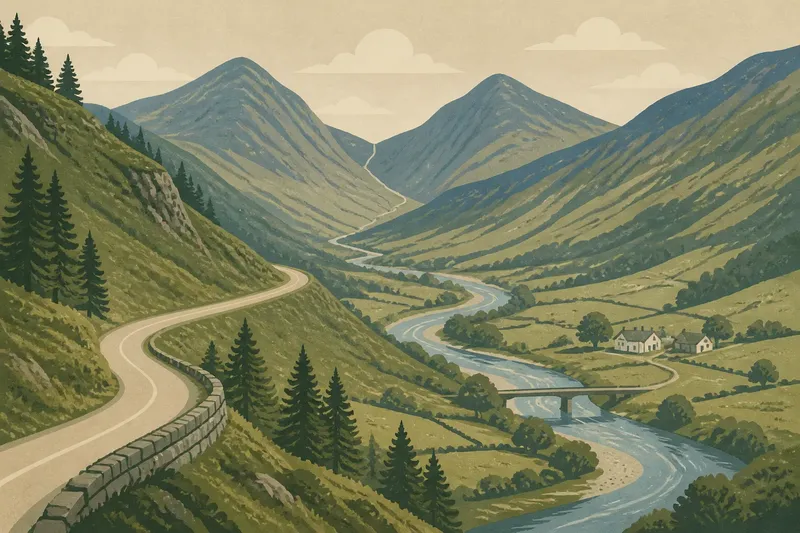
On a folded road map, a lane may seem to wander for no good reason: it follows a stream, bends around a shoulder of land, then climbs toward a notch between hills. That pattern is often the landscape explaining itself. Why a valley changes the route of a road is easier to see when you look for the ground a road can use, not just the distance between two places.
This is a decision guide for reading those clues. Start with the feature that dominates the stretch you are looking at—steep slopes, a stream crossing, or a pass—and ask what route it makes plausible. A road’s line is not proof of a single cause, but the surrounding land can narrow the likely explanations.
Choose the slope when the valley sides crowd the route
Begin with the valley’s cross-section. If the floor is broad and gentle, a road may run close to the stream or through open ground. If the valley narrows and its sides rise sharply, the direct line may be difficult to follow. A road can instead cling to a bench, the relatively level shelf that sometimes cuts across a hillside, or climb and descend through gentler terrain.
Look at the contours on a topographic map. Contour lines close together indicate a steeper slope; lines farther apart indicate gentler ground. Where tightly packed contours press toward the valley floor, a road that keeps a steady height may curve along the slope rather than descend to the stream. In the landscape, that route can appear as a shelf cut into the hillside, with a bank rising on one side and open valley below.
This choice fits a route where staying on a hillside seems more practical than repeatedly dropping to the valley bottom. The trade-off is a longer, curving course. The direct line may be shorter on a map, but it could cross more difficult ground or require abrupt changes in elevation. A contour map is a clue, not a construction record: the road might also reflect later engineering, land ownership, or changes in how the route is used.
To compare possibilities, trace the road alongside the contour lines rather than judging its shape alone. A road that follows roughly similar elevations for a while may be using a hillside shelf. A road that cuts across many contour lines in a short stretch may be climbing or descending a steeper face. Check both sides of the valley before deciding which interpretation fits.
Choose the valley floor when the stream offers a usable corridor
A stream can provide a natural guide through otherwise uneven terrain. The valley floor may be the easiest continuous route, especially where the river bends through a broad, low area. In that situation, a road may track the watercourse without crossing the slopes at all. Its bends then echo the stream’s bends, although the road may take a slightly different line to avoid wet ground or follow a stable edge.
Inspect the space between the water and the valley sides. A broad strip of relatively level land gives a route more room to pass. A narrow floor, where the stream lies close to a steep bank on one or both sides, leaves fewer options. The road may switch from one side of the valley to the other, climb onto a shelf, or leave the valley for a gentler route over higher ground.
Stream crossings are especially revealing. A bridge, ford, or road approach can mark a point where the channel and banks make crossing more convenient than nearby alternatives. Look for a narrower channel, a low approach on each bank, or a place where the road reaches the water at a manageable angle. These clues can explain why the road bends to reach one crossing instead of continuing straight toward another.
Do not assume that the road always hugs the water because the river is the easiest guide. Flood-prone ground, marshy margins, or unstable banks can make the immediate stream edge a poor route. A road that stays on slightly higher ground may be avoiding those conditions while still using the valley as a corridor. The map may show a stream and road near each other without revealing how much level space lies between them.
Choose the pass when the road must cross a ridge
When a road leaves one valley for another, search for a low point in the intervening ridge. A pass is a natural gap or relatively low route through higher ground. It can spare a road from climbing to a summit and then dropping down the opposite side, so the route may bend toward a pass that looks out of the way from the valley floor.
On a topographic map, follow the contours across the ridge. They often form a notch or saddle where the land dips between higher slopes. A road approaching from below may curve toward this dip, cross the ridge there, then descend into the next valley. On the ground, the pass may feel like a broad hollow rather than a dramatic opening. The best clue is the way the surrounding slopes fall away on both sides.
This explanation fits a road that connects two valleys through a lower crossing. It is less convincing if the route simply follows a valley without crossing a ridge, or if no suitable low point lies near its course. In those cases, slope shelves and stream crossings may explain the bends better. More than one feature can shape the same route: a road may follow a stream for part of its length, then turn toward a pass.
Imagine a road that appears to take a long detour around a steep-sided valley before reaching a neighboring settlement. If the map shows a low saddle in the ridge on that curved approach, the pass offers a plausible reason for the detour. You would expect the road to climb toward the saddle and then descend on the far side, rather than cross the highest part of the ridge. That visible sequence supports the interpretation without proving who chose the route or why.
Choose the clue that matches the road’s shape
Different shapes point to different terrain constraints. Use the strongest visible clue first, then check whether the other features support it:
- A long curve at a steady height: Look for a hillside bench or a band of gentler contours. This fits a route staying above a constricted valley floor.
- A winding route near water: Check whether the valley floor is broad enough to carry both stream and road. If the road shifts away from the channel, look for wet ground or steep banks.
- A bend at a bridge or ford: Compare the crossing with nearby banks and approaches. A local change in the channel or slope may explain why the road crosses there.
- A climb toward a notch: Follow the ridge contours for a lower saddle. This fits a route that must pass between neighboring valleys.
- A sudden departure from the valley: Check whether the valley narrows, steepens, or ends against a ridge. The road may be seeking a more passable line beyond it.
For an initial reading, use a topographic map alongside a standard road map. The road map makes connections and bends easy to follow; the topographic map shows elevation, streams, and ridges. A satellite image can help distinguish open valley floor from wooded slope, but tree cover and shadows can obscure the land’s shape. If you are examining a real route, local maps or signs may clarify which road segment you are viewing.
Which landform best explains the detour?
Why does a road follow a contour?
A road may follow a contour to keep near a similar elevation across a hillside. This can make sense where descending to the valley floor would mean crossing steeper ground or climbing again soon afterward.
Why does a road cross a stream at a bend?
A bend alone does not explain a crossing, but the local banks may offer a suitable approach or a narrower channel. Compare the road’s angle, bank height, and nearby valley floor before deciding what the crossing point suggests.
How can I spot a pass on a map?
Look for a dip in the ridge where contours form a saddle between higher ground. A road that climbs toward this low point and descends beyond it may be using the pass to connect valleys.
Can one valley produce several different road routes?
Yes. A road may use a stream corridor in one section, a hillside bench in another, and a pass where it crosses a ridge. Read each stretch against its local terrain instead of assigning one explanation to the entire valley.
Read the whole route before settling on a cause
A road’s bends become legible when you match each one to the land feature it appears to avoid or use. Start with the steepest slopes if the route holds a steady height; focus on stream crossings if it repeatedly meets the water; look for a pass if it climbs across a ridge. Then trace the neighboring stretch. A bend that seems odd in isolation may make sense as the link between two easier sections.
The phrase why a valley changes the route of a road points to a useful habit of observation: compare the line with the ground, one segment at a time. Treat contours, banks, shelves, and saddles as clues rather than final answers. That approach makes even an apparently indirect road easier to read, while leaving room for local choices the map cannot show.