The Long Life of the Village Green
Learn how to trace a village green’s history through its boundaries, local names, records, and changing uses, without mistaking appearance for evidence.
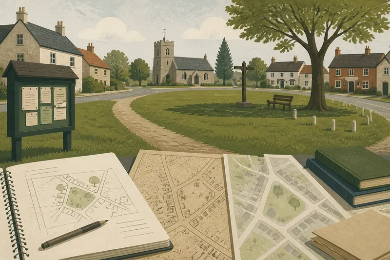
A worn path crosses the grass beside a village noticeboard, and a few homes face the open space. To trace the history of a village green, begin with these visible details, then ask what the ground was called, who used it, and how its boundaries changed. A grassy common at the village center is only one possible form.
Read the landscape before naming it
Visit the open ground, or study it on a current map if you cannot go in person. Note its shape and position: does it sit beside a church, road junction, stream, inn, or row of homes? Look for paths, gates, benches, trees, signs, a pond, or a village pump. These are clues about use, not proof of a single origin.
Record what appears public, what looks privately managed, and where fences or walls meet the open area. A broad lawn may have been planted as a formal recreation ground, while an irregular space may preserve an older shared use. Appearance alone cannot settle the question: later landscaping can make an old space look new, and a modern park can take on the everyday role associated with a village green.
Make a simple sketch or mark features on a printed map. Keep observations separate from guesses. Write “path crosses the grass,” for example, rather than “route used by villagers for centuries.” That distinction prevents a visible feature from turning into an unsupported story.
Check what the name refers to
Search local maps, directories, council records, and historical documents for names associated with the site. “Green” may appear in a place name without identifying a formally recognized village green. A shared open space might instead be called a common, glebe, croft, or recreation ground. These terms can point toward different histories, though local usage is not always consistent.
Check whether a name refers to the whole village, a neighborhood, or a particular piece of ground. On older maps, compare the label’s position with the present site. A name printed near a crossroads might describe the settlement around it rather than the grass itself. Local history books, parish records, and archive catalogues can help clarify how people used the term.
Ask a local library or archive about estate maps, parish plans, and records of public land. In England and Wales, a local authority’s register of town and village greens may also be relevant. Registration is a legal status, not a general synonym for green space; distinguish a registered site from an informal local name.
Compare maps to trace changes
Place an older map beside a current one and compare the outline, nearby buildings, and routes into the space. Ordnance Survey maps, tithe maps, estate plans, and parish maps may show different levels of detail. Their symbols and conventions vary, so read the map key and do not assume that every blank area was shared land.
Look for signs that the site was divided, enclosed, planted, built upon, or reshaped. A new road might cut off an approach; a boundary could reduce the open area; a later row of houses might face a patch that once sat farther from the settlement. Note which changes are visible on each map and which remain uncertain. A map records selected features at a particular moment, not every activity or local understanding.
Say you are tracing a small green beside a village crossroads. An older estate plan shows a wider open patch, while a later map marks a school on one edge and a bounded lawn on the other. You note the two map outlines, compare the dates, and then check school and parish records for further context. The resulting account can describe a change in the space while leaving its cause open if the records do not explain it.
Look for evidence of everyday use
Shared spaces supported different activities. Grazing animals, drawing water, drying goods, holding a fair, playing games, and meeting informally can leave traces in records and in the shape of a place. A pond or pump might suggest a practical function; a level central lawn could suit recreation. Neither feature proves a particular use without supporting evidence.
Look for mentions in parish minutes, local newspapers, photographs, oral histories, and old guidebooks. Search for the site’s name as well as broader terms such as “common,” “fair,” or “cricket.” Records may describe disputes over access, maintenance, or events; those disagreements can show that different groups understood the space in different ways.
Pay attention to who appears in the sources. Formal records may emphasize landowners, parish officials, or organized events while overlooking children’s play, women’s work, or everyday passage. State what a record says and acknowledge what it does not show instead of filling gaps with a romantic image of universal community use.
Which clues help distinguish names and uses?
Was every village green a common?
No. “Common” can refer to rights of use over land, while “green” may be a local name or a description of open ground. The terms are not interchangeable everywhere.
Did every green stand at the village center?
No. A shared open space might sit at the settlement’s edge, beside a road, or near a water source. Its location may reflect local needs and later growth rather than a standard village plan.
Could a recreation ground be mistaken for an older green?
Yes. A purpose-made recreation ground may look like a traditional green, especially after trees and paths mature. Maps, land records, and the history of its name can help distinguish its creation and role.
What if historical records disagree?
Keep both accounts visible and identify what each source describes. A map may show a boundary while a newspaper reports an event; neither necessarily answers the same question.
Write a history that shows what is known
Arrange your notes in a simple sequence: the earliest evidence you have located, later changes to the space, recorded uses, and its present appearance. For each claim, note its source and date or period. When a link is plausible but not directly documented, use careful wording such as “may have served,” “appears on,” or “is described in.”
Separate the site’s physical history from its social history. A boundary can change while local gatherings continue; a familiar name can survive after the use that gave it meaning has faded. A new recreation ground can also become a valued shared place without inheriting an older common’s history.
The long life of a village green is best understood by asking how its form, name, access, and uses changed together—or did not. A clear account of the village green’s history can preserve that complexity: name the evidence, mark what remains uncertain, and leave residents with a sound starting point for further local research.